On Route 66 in our '67: The Classic Experience
Starting time: 7:45 AM CST, Amarillo, TX
Starting mileage: 58744
Yesterday's mileage: 571
These are the long days, on long, mostly straight intertates with few outposts of civilization. The hours en route are artifically shortened by the fact that we are gaining time as we head west.
Amarillo was shrouded in cowshit-scented fog as we pulled out onto the westbound highway this morning before 8 AM seeking a place for breakfast and coffee. Except that we hadn't realized we were staying on the western edge of town, and within a mile we were once again on the open road with not even a truck stop in sight. Thankfully, almost as soon as we cleared the city limits the dense fog lifted, exposing unpopulated prairie as far as the eye could see, broken only occasionally by things like a small windfarm or a stockyard. I am VERY cranky when I don't have coffee and some food in the morning, so between that and the fog, the fifteen or so miles to tiny Vega, TX, where we filled both the Duchess's tanks and our own were pretty tense indeed.
Sign on the road: "Don't Mess up Texas! $400 fine for littering."
Shortly after you cross the state line into New Mexico, the landscape changes, with the famed colored sandstone mesas rising in the desert. Overpass bridges are cast in colored concrete and decorated with bas-relief Native American symbols. Large sculptures in copper, bronze, stainless steel appear every so often along the sides of the highway, especially near larger towns like Albuquerque and Gallop. Albuquerque's interstate highway junctions, cast in shades of salmon and sky blue, are works of art in themselves. We laughed to see a tumbleweed snowman perched on the side of the road.
But between the far-flung towns, scenery is pretty monotonous on the road. Which makes the stops for gas and snacks an event that the truck stop retailers have learned to capitalize upon. At one such stop, called Clive's Corner (no corner at all. It was the only thing off the offramp, at an intersection of I-40 and a road that led north to Santa Fe and south to Roswell), the building contained a Subway, a convenience store, and a souvenir and gift shop the size of a supermarket. The merchandise included every form of tacky souvenir and "Indian" crafts mostly made in Mexico or China.
All the highways we have thus far travelled are part of the Eisenhower Interstate System, created as a result of the Federal Aid Highway Act of 1956. As you can see by the map, this is a vast system of roadways, almost all of them kept in great shape. (New Mexico has periodic signs informing you what a stretch of roadwork is costing, and when it is slated to be completed.) And no wonder. It is said that every item we buy has been on the interstate system at some point. Eisenhower considered the act one of the greatest accomplishments of his two terms in office, and historians agree.
On a related subject, one of the sights common along Rte 66 are the freight trains that seem to always be heading east. Often these trains are several MILES long, and the cars each contain a double stack of shipping containers, pulled by four engines. Less frequently, we'll see a train loaded with coal or perhaps other minerals. Again, these trains can be two hundred cars long. It is mind boggling, impressive, and very humbling to see what must be unimaginable quantities of goods being transported over this vast nation.
The long days' travel across plains and desert does not prepare you for the fact that you are actually climbing...by the time we were partway across Arizona the elevation was 5000 above sea level. And then, most surprisingly, you rise from the desert into a forest which surrounds Flagstaff, AZ, a pine-covered outpost 7000 ft above sea level.
That's our stop tonight.
Tomorrow...California!
Arrival time: 6:15 PM MST (7:15 CST)
Starting mileage: 58744
Yesterday's mileage: 571
.jpg) |
| The mesas of Arizona |
Amarillo was shrouded in cowshit-scented fog as we pulled out onto the westbound highway this morning before 8 AM seeking a place for breakfast and coffee. Except that we hadn't realized we were staying on the western edge of town, and within a mile we were once again on the open road with not even a truck stop in sight. Thankfully, almost as soon as we cleared the city limits the dense fog lifted, exposing unpopulated prairie as far as the eye could see, broken only occasionally by things like a small windfarm or a stockyard. I am VERY cranky when I don't have coffee and some food in the morning, so between that and the fog, the fifteen or so miles to tiny Vega, TX, where we filled both the Duchess's tanks and our own were pretty tense indeed.
Sign on the road: "Don't Mess up Texas! $400 fine for littering."
.JPG) |
| One of the metal sculptures along I-40 in New Mexico |
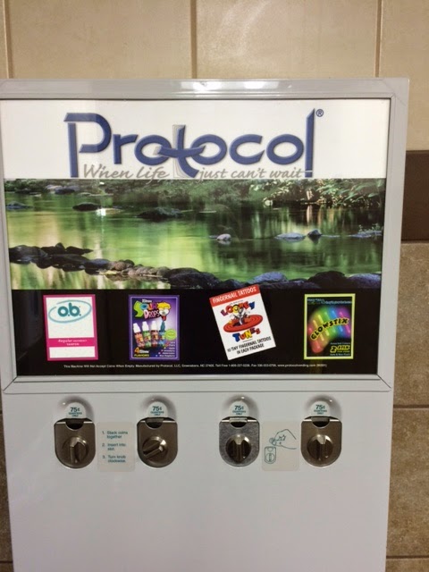 |
| The bizarre vending options in a truck stop in New Mexico |
But between the far-flung towns, scenery is pretty monotonous on the road. Which makes the stops for gas and snacks an event that the truck stop retailers have learned to capitalize upon. At one such stop, called Clive's Corner (no corner at all. It was the only thing off the offramp, at an intersection of I-40 and a road that led north to Santa Fe and south to Roswell), the building contained a Subway, a convenience store, and a souvenir and gift shop the size of a supermarket. The merchandise included every form of tacky souvenir and "Indian" crafts mostly made in Mexico or China.
.jpg)
Whereas New Mexico seemed to want to emphasize the artistic, Arizona's interstate commerce seemed determined to invoke the classic era of the Route 66 road trip, with (intentionally?) kitchy Navaho trading posts (advertised for ten miles on either side with dozens of billboards), or stylized forts, or crumbling circa 1950's camper/RV parks. Anything to draw the family with a backseat full of bored children to a stop. (I know. We were those children 40 years ago.)
All the highways we have thus far travelled are part of the Eisenhower Interstate System, created as a result of the Federal Aid Highway Act of 1956.
As you can see by the map, this is a vast system of roadways, almost all of them kept in great shape. (New Mexico has periodic signs informing you what a stretch of roadwork is costing, and when it is slated to be completed.) And no wonder. It is said that every item we buy has been on the interstate system at some point. Eisenhower considered the act one of the greatest accomplishments of his two terms in office, and historians agree.On a related subject, one of the sights common along Rte 66 are the freight trains that seem to always be heading east. Often these trains are several MILES long, and the cars each contain a double stack of shipping containers, pulled by four engines. Less frequently, we'll see a train loaded with coal or perhaps other minerals. Again, these trains can be two hundred cars long. It is mind boggling, impressive, and very humbling to see what must be unimaginable quantities of goods being transported over this vast nation.
The long days' travel across plains and desert does not prepare you for the fact that you are actually climbing...by the time we were partway across Arizona the elevation was 5000 above sea level. And then, most surprisingly, you rise from the desert into a forest which surrounds Flagstaff, AZ, a pine-covered outpost 7000 ft above sea level.
That's our stop tonight.
Tomorrow...California!
Arrival time: 6:15 PM MST (7:15 CST)


I've got your mail. No sign of glasses as yet. xoxlinda
ReplyDeleteeeek. *kitschy*
ReplyDelete